Spatiotemporal Tracking of Dynamic Structures
Academic Research · Algorithm Design & Data Processing · TU Delft
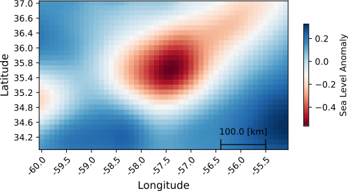
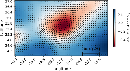
Contributed to building a full-stack Python pipeline to detect, filter, and track dynamic spatiotemporal structures (oceanic eddies) from large-scale, noisy satellite data.
Python
Satellite Data
Geophysics
Tracking
Completed
technical stack
- Languages & Tools: Python, NumPy, SciPy, Matplotlib, NetCDF4, custom plotting functions
- Algorithms: Finite-difference derivatives, time-series filtering, parameter sweeps
- General Skills: Numerical methods, spatiotemporal data processing, tracking/filtering pipelines, structured code design
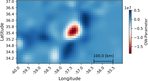
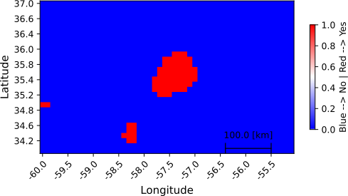
detection pipeline
key contributions
- Gradient-Based Feature Extraction: Computed velocity, vorticity, and strain tensors from scalar fields using finite-difference approximations and derivatives on an adaptive grid.
- Dynamic Thresholding: Designed flexible filtering pipelines with tunable cutoffs based on region statistics (standard deviation, radius, lifetime, depth), balancing precision and noise rejection.
- Correlation Analysis: Matched detected structures with independent scalar fields (e.g. temperature) and quantified relationships through statistical averaging and classification.
- Data Visualization: Automated generation of dynamic maps, heatmaps, and time-series plots to support analysis and debugging of the full pipeline.